
How an Upshur Property Search Runs
MapWV is the public starting point. It serves an Upshur County property search through four modes: Basic, Appraisal/Sales, Advanced, and Prior Ownership. The form takes an owner name, street, full parcel ID, map number, or legal description. Each result opens in the Property Viewer. Treat it as a first pass. The portal does not replace the Clerk's grantor-grantee index, and it does not state how far back Prior Ownership reaches.
- Enter Upshur County and a partial or full street name, owner name, or known parcel component.
- Turn on the legal-description and GIS-ID display, then note the owner, mailing and situs lines, values, acreage, and deed reference.
- Open the mapped result and confirm that the road and parcel shape fit the intended property.
- Use the legal description and parties to request the corresponding deed or other instrument from the County Clerk.
- Check tax billing separately with the sheriff or tax office; a public Upshur bill-search URL was not verified.
MapWV Fields for Upshur Parcels
The MapWV fields reward precision. A broad street query narrows fast. District, map number, parcel, sub-parcel, and full parcel ID each act as separate controls. Owner name, property class, tax class, and land-use choices are available too. Appraisal/Sales mode adds ranges for land and building values. It also covers total appraisal, calculated and deeded acres, sale dates, and sale price.
Advanced controls go further still. Mailing address, deed book and page, and legal description each narrow a query. So do building year, building area, structure counts, and flood-hazard filters. A field on the portal is not a promise of complete Upshur data. An older deed may cite a community or road name instead of a street address. Legal-description text and the map key beat a ZIP code. They link the record to the parcel far better than postal geography can.
| Search group | MapWV controls | Use in a search |
|---|---|---|
| Parcel identity | District, full parcel ID, map, parcel, sub-parcel | Exact match after the first result |
| Owner and location | Owner name, street name, mailing address | Address entry or owner variant search |
| Value and sale | Land/building/total ranges, date and price ranges | Assessment or transaction filtering |
| Record references | Deed book, page, legal description, GIS ID | Follow-up with Clerk or parcel viewer |
| Land and building | Acreage, land use, year, area, structure counts | Check that the selected parcel is plausible |
What an Upshur Search Result Shows
A MapWV parcel result is a working card. It is not a certificate of title. The result can show the owner of record, mailing address, situs, district, map and parcel parts, tax class, land use, legal description, acreage, and structure details. Valuation components and exemption indicators appear as well. So do sale fields, a deed reference, GIS ID, flood flag, and map link. Treat the inventory as a checklist. Read each field against the recorded instrument.
| Owner of record | Name shown on the assessment roll; not a title opinion |
|---|---|
| Mailing and situs | Tax-notice destination and physical property address, which can differ |
| District / parcel key | County district, map, parcel, sub-parcel, and GIS parcel ID |
| Value components | Land, improvement, total, appraisal, and assessment-year fields |
| Legal description | Text that can bridge a street lookup to an older deed |
| Sale and deed reference | Date or price if displayed, plus book/page or instrument detail |
Check the sale field against the recorded instrument first. A portal value is not automatically a sale price. The assessment record may lag an update or carry a field that needs local interpretation. Copying the parcel ID into the map viewer is easy. Yet neither the result nor the GIS polygon proves a boundary. If the match looks close but imperfect, requery with the legal description, owner name variants, and map components. Do this before calling the Clerk.
Address, Owner, or Parcel Key
The best query depends on which fact is solid. An address is easy to recall. But rural-route wording, abbreviations, and old street names can break it. Owner search may return several parcels at once. Punctuation, initials, married names, trusts, estates, and LLC suffixes can also split the results. The full parcel ID is the strongest exact key once known; save it with every component intact rather than trimming leading characters or inventing separators.
| Entry clue | Strongest use | Likely snag |
|---|---|---|
| Street name | Find a known property and nearby results | Address format or historic name may differ |
| Owner name | Find multiple parcels tied to a person or entity | Variant spelling or legal entity name |
| Parcel ID | Repeat the same parcel across systems | District and sub-parcel parts must stay exact |
Mailing Versus Situs Address
The situs address tells you where the property sits. The mailing address tells you where the tax bill goes. An owner may list a post-office box, a second home, or an out-of-county address. A rural community name can sit outside the city limit too. So can a Buckhannon postal identity. Neither the mailing line nor the ZIP proves residency at the parcel. It also does not confirm location inside a municipality.
For a parcel near a line, check the map. Confirm city jurisdiction with Buckhannon before making any permit request. The MapWV form exposes no dedicated ZIP field. Rely instead on street, owner, parcel, or mailing-address text within the form. Postal geography is a weak parcel key.
Search the Upshur Street Record
The MapWV assessment portal shows the search form used for Upshur parcels. Its tabs run Basic, Appraisal/Sales, Advanced, and Prior Ownership, with result counts varying by county and query.
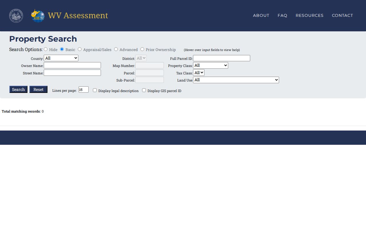
MapWV also offers a "View in Property Viewer" route. Find the intended polygon there. Copy its GIS ID back into your notes. If the road label misaligns, include both the parcel ID and legal description so the Clerk can search the grantor-grantee index without an address-only query.
Upshur Owner-Name Variants
Spelling sinks more Upshur County name searches than any other mistake. Start with the name on a Upshur County tax notice. Then run the assessor name field through its likely variants. Try initials, a middle name, a former surname, “Estate of,” or an entity suffix. A trust may be indexed under the trustee or the trust name itself. A business grantee often uses its formal Secretary of State name. It rarely matches the storefront one customers know. The WV Business Entity Search decodes most organizations registered in the state. An advanced mode searches by agent or officer. But it cannot prove parcel ownership. An LLC may appear in a recorded deed. Keep its full legal spelling when you request the instrument from the Clerk. A statewide business result can show entity type and status. It may also list address, registered number, creation date, and agent contact. Treat those fields as a clue. They never substitute for the conveyance itself.
From MapWV to the Clerk's Index
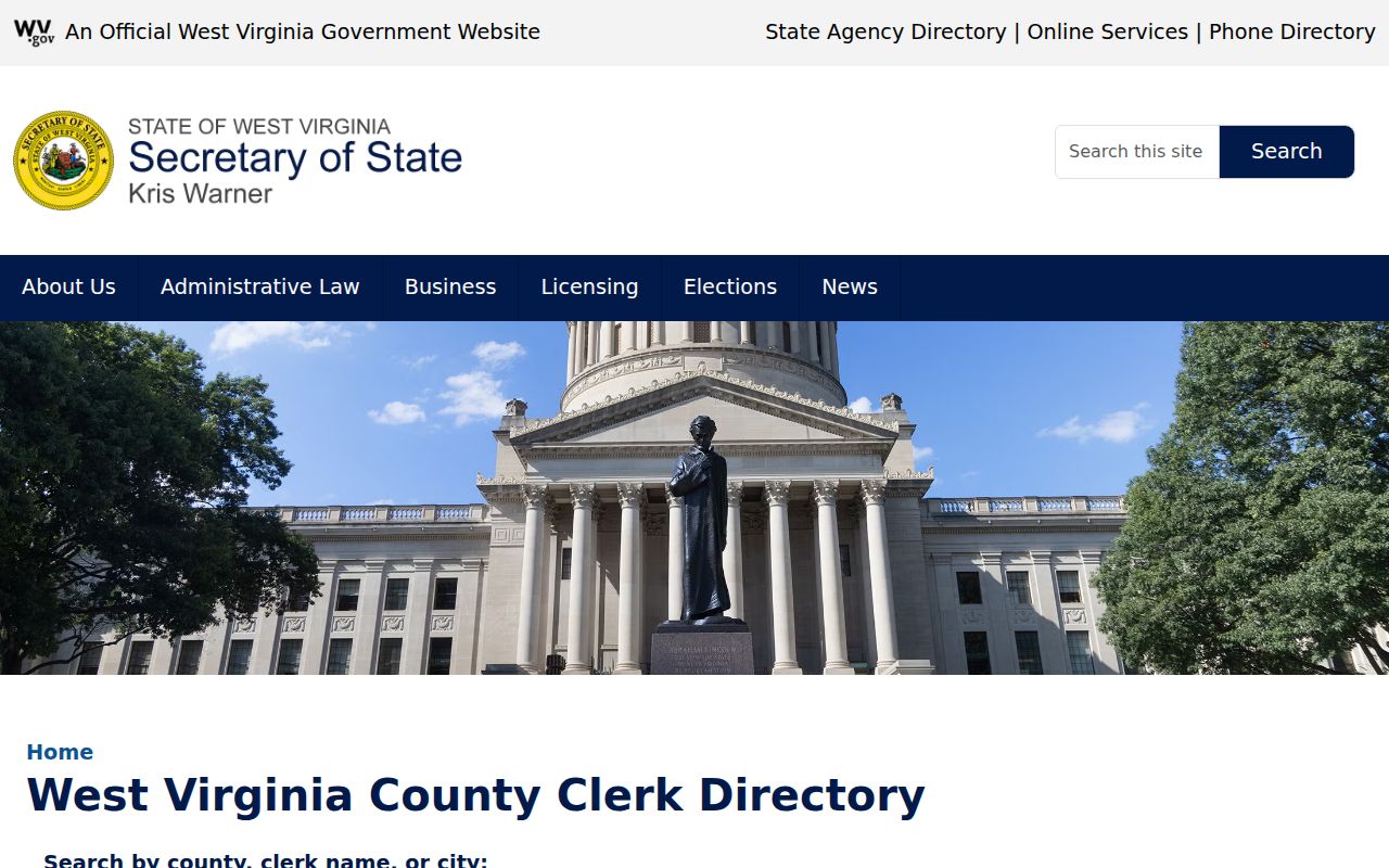
Upshur County publishes no public online deed index. So start one office earlier, with the assessor. The parcel card there supplies the owner of record, the legal description, the district and parcel number, and any deed book or page shown. Carry those details into the Clerk's grantor-grantee index. That index runs on party role and date range, not street addresses. An address-only request may come up empty. Before visiting, ask whether records are open for counter inspection, whether image access covers the year you need, and how copies are requested. If a vendor offers an online recorder index, confirm its coverage and charges with the County Clerk first. Electronic recording through CSC exists too. It is a submission channel for documents, not a public title-search portal. Use it to file, not to browse. The West Virginia County Clerk directory lists contact details for the Upshur Clerk and helps confirm the right office before a request.
When the Upshur Web Trail Stops
Some instruments never surface online. The County Clerk is the fallback. Request a name search as both grantor and grantee. Give the Clerk a date range, the document type, and the legal description. Include the book and page if you know them. Older land trails sometimes predate the county itself. Ask the Clerk or the West Virginia Archives which predecessor record group fits your description. The county publishes no year-by-year imaging cutoff. Do not assume the portal holds every historic book. Once an instrument turns up, the Upshur County deed records instructions lay out which details to request and how the deed chain links owners over time.
Choosing an Upshur Search Key
Match the search key to the question. An owner's name works when the goal is every parcel tied to a person or business. A street name pulls a single situs record. It can also surface nearby results. District and parcel components work once the assessor supplies them. Whatever the key, compare the legal description and mailing address with the physical property before carrying the result forward.
| Search Key | Best For | Where It Works | Watch Out |
|---|---|---|---|
| Street address | Locate a known residence or site | MapWV assessment and parcel viewer | Old roads and rural formats |
| Owner name | Find parcels for a person, estate, or entity | MapWV; Clerk index by grantor/grantee | Spelling and entity variants |
| Full parcel key | Match one parcel between offices | MapWV, GIS, tax and Clerk requests | Keep district and sub-parcel parts |
- Parcel ID
- The assessor and GIS key for one mapped tax parcel.
- Situs address
- The physical location tied to the improvement.
- Owner of record
- The name shown in the current assessment record.
- Legal description
- The written land description used to identify the conveyed tract.
Not a title search. An Upshur County property search shows the fields available in the public systems, not every possible interest or correction. Confirm the latest recorded deed with the Clerk and use a title professional when clear ownership must be established.